
GPR Survey company in Moradabad, Uttar Pradesh |It is a non-destructive geophysical method used to image the subsurface.
Ground‑penetrating radar (GPR) transmits short electromagnetic pulses into the ground and records reflections from subsurface interfaces to produce 2D profiles and 3D volumes. GPR is fast, non‑destructive, and best for shallow targets (centimetres to a few metres) in low‑conductivity materials.
Typical applications
• Utility locating (pipes, cables) and concrete scanning.
• Archaeology and forensic searches for buried features.
• Geotechnical mapping of voids, layers, and shallow stratigraphy.
• Environmental work for shallow contamination or buried drums.
GPR survey design depends on target size, depth, and required resolution.
Equipment, settings and metadata
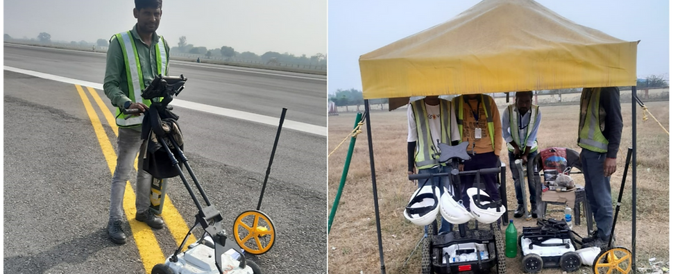
• Core components: control unit, antenna(s), positioning/GPS or survey wheel, and marking tools.
• Key settings: time window (controls max depth), gain (amplifies weak returns), stacking (improves signal‑to‑noise), and background removal to reduce system/ground coupling noise.
• Record metadata: antenna model and frequency, line IDs, start/end coordinates, survey speed, environmental conditions, and calibration values; good metadata is essential for reproducible interpretation.
Field collection and processing workflow
• Collect orthogonal grids where possible to aid 3D imaging and reduce ambiguity.
• Use consistent speed and antenna coupling; mark control points and anomalies on the surface.
• Processing steps: time‑zero correction, dewow/high‑pass filtering, gain compensation, background removal, migration and depth conversion using the measured dielectric constant. Interpretation combines processed profiles, plan maps, and ground truth where available.
Survey planning and design
• Define the objective: target type, depth, minimum feature size, and required resolution.
• Choose antenna frequency: higher frequencies (e.g., 500–1000 MHz) give higher resolution but shallower penetration; lower frequencies (e.g., 100–250 MHz) penetrate deeper with lower resolution.
• Layout: plan parallel profiles with station spacing to sample the smallest feature (typical line spacing 0.1–0.5 m for detailed work).
• Pre‑survey tasks: site walk to note surface conditions, obstacles, and safety hazards; run a few test lines to refine settings and estimate the subsurface dielectric constant for depth conversion.
Limitations and best practices
• Limitations: poor performance in conductive soils (clays, saline), trade‑off between depth and resolution, and ambiguous hyperbolic reflections that need careful interpretation.
• Best practices: run test lines, choose frequency to match target, collect orthogonal lines, keep detailed metadata, and validate with selective excavation or other geophysics when possible.
GPR Survey company in Moradabad, Uttar Pradesh |It is a non-destructive geophysical method used to image the subsurface.
GPR Survey company in Moradabad | FRATECH ENTERPRISES
GPR Survey company in Moradabad, Uttar Pradesh.|GPR Services, Utility Locating Services, Concrete Scanning Services, Site Investigation, Subsurface Assessment, Report, Data Interpretation

GPR is a versatile near‑surface imaging tool used to locate and map shallow subsurface features non‑destructively across engineering, utilities, archaeology, environmental and polar applications.
Applications of GPR
Ground‑penetrating radar (GPR) transmits electromagnetic pulses and records reflections from subsurface interfaces to produce 2D profiles and 3D volumes; it is fast, non‑destructive, and best suited for shallow targets in low‑conductivity materials.
Major application areas
Common applications include utility and asset locating for buried pipes and cables; concrete inspection for rebar, voids and delamination; archaeological prospection to map graves, walls and features; geotechnical mapping of stratigraphy, voids and sinkholes; environmental surveys for buried drums and shallow contamination; landmine and UXO detection; and glaciology for ice thickness and internal layering studies.
Specific use cases and advanced applications
GPR supports 3D imaging and volume rendering from dense grids for complex sites; tunnel and pavement condition assessment; monitoring of active faults and subsidence; forensic searches for clandestine burials; and integration with other geophysics (magnetics, resistivity) for improved interpretation.